Home » Locations
Home and Away Locations
Information on many of the outdoor locations used to film Home and Away.
Please note, we no longer offer the Home and Away tour, but it continues to be available from CelebTime. For queries on existing bookings, please email [email protected]
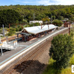
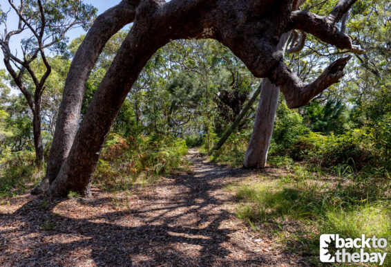
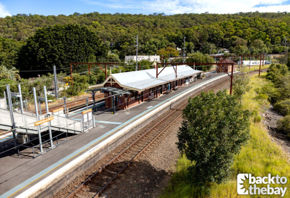
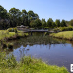
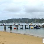
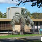
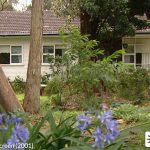
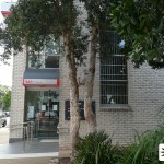
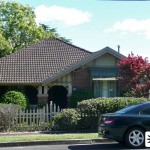
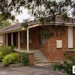
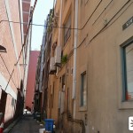
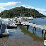
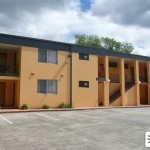
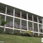
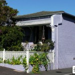
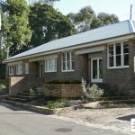
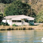
Yabbie Creek Train Station (1991)
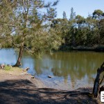
Hawkesbury River Station
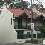
Dangar Road
Brooklyn NSW 2083
In October 1991, Sophie Simpson and Simon Fitzgerald headed into the city to see a Ratcat concert, opting to drive into Yabbie Creek on Michael’s advice and take the train from there. Simon accidentally purchased single tickets, and later didn’t have time to purchase additional tickets for their return as they rushed to catch the […]
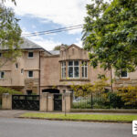
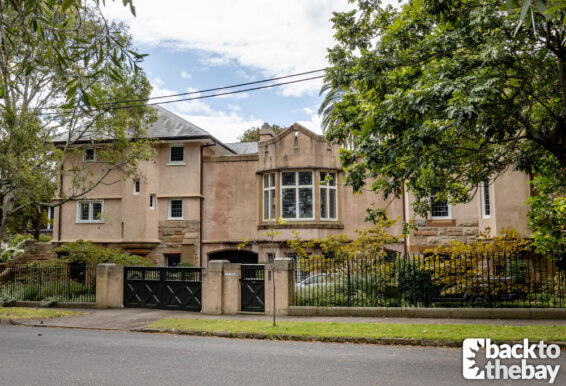
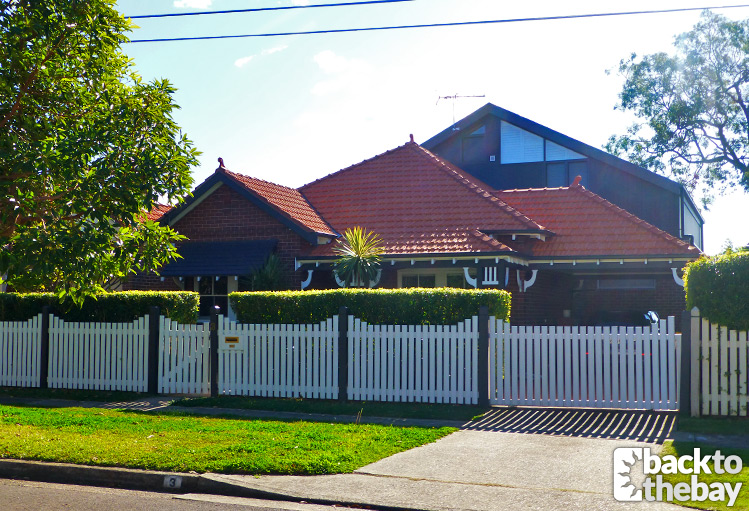
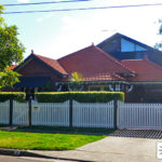
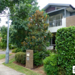
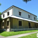
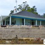
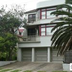
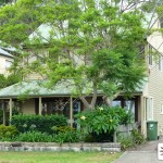
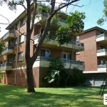
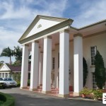
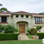
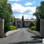
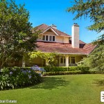
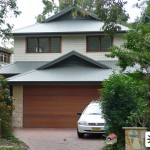
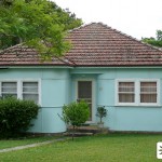
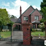
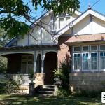
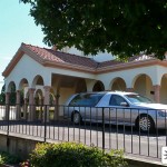
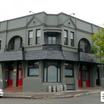
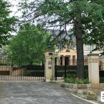
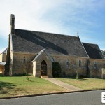
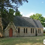
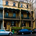
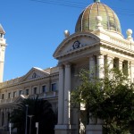
Carter House
Crossways
50 Martin Road
Centennial Park NSW 2021
In Episode 8151, airing in Australia in November 2023, Remi Carter took girlfriend Bree Cameron to his family home in the city to meet his parents, as they threw a party for their 35th wedding anniversary celebrations. Although Graham and Nicola were known to be well off, having made a name for themselves in one […]
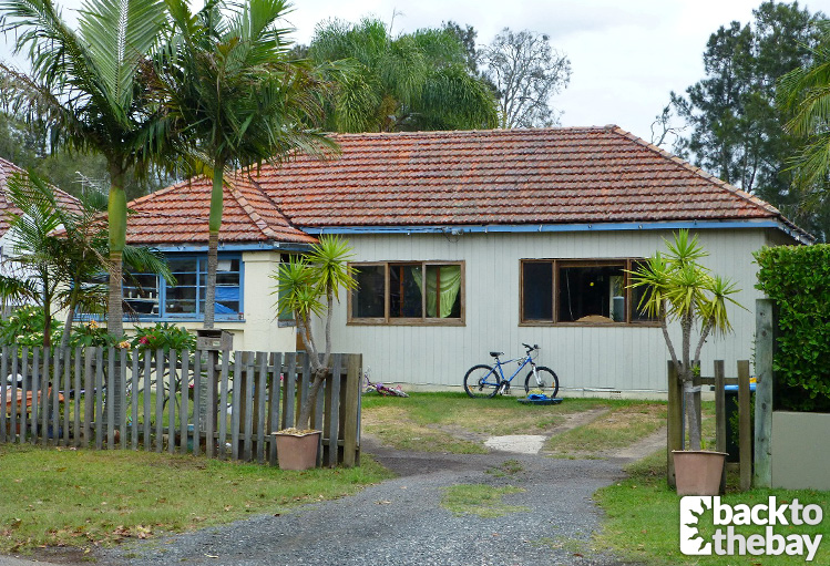
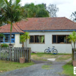
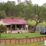
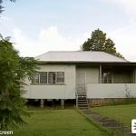
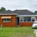
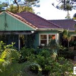
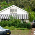
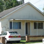
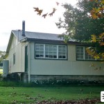
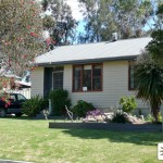
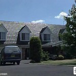
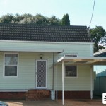
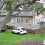
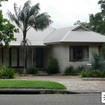
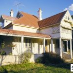
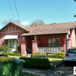
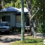
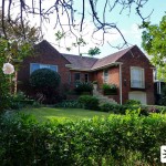
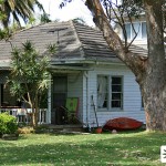
Travis’s House (1995-2000)
6 James Road
Brooklyn NSW 2083
In April 1995, the character of Travis Nash was introduced to the show, said to be a local who had lived in Summer Bay his entire life. His family home made its first appearance a few weeks later, with the exterior shown for the first time via a stock shot in Episode 1687, and the […]
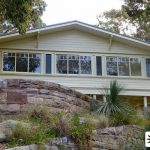
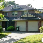
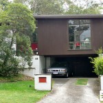
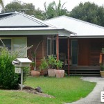
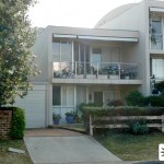
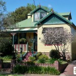
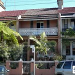
Levi and Imogen’s House
13 Fourth Avenue
Willoughby East NSW 2068
Having learned that her brother Levi had made a trip to Summer Bay without visiting her, with the pair having only recently reunited after more than a decade of estrangement, Eden Fowler’s curiosity was piqued. Whilst Levi claimed he was in the area visiting patients and didn’t have time to drop in, little did Eden […]
Morgan Family Graves
Fagan Park
38-48 Arcadia Road
Galston NSW 2159
In 2017, the Morgan family were at breaking point after Mason had been injured in a car accident caused by Brody’s drug habit. Mason refused to forgive his brother after being temporarily paralysed, and as a last ditch attempt to bring the warring brothers back together, Justin forced the entire family to take a road […]
Tane & Felicity’s Wedding
McKay Reserve
McKay Road
Palm Beach NSW 2108
Episode 8000, airing in Australia in March 2023, saw the marriage of Tane Parata to Felicity Newman. It had been a long road to the altar following four proposals between the pair of them, and after getting fed up of waiting for Eden and Cash to organise a planned beach wedding, Flick and Tane decided […]
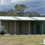
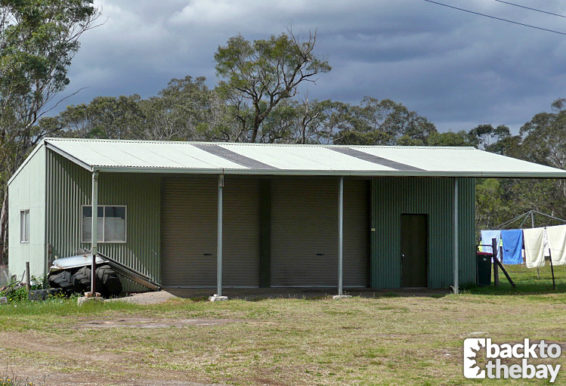
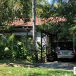
Jesse & Ken’s Garage
194 Cattai Ridge Road
Maraylya NSW 2765
In late 1999, Jesse McGregor bought an old bodyshop on Beach Road in order to set up his own garage. It only took a matter of weeks before Jesse managed to find himself involved in illegal activity, when an old associate from his criminal past, Mick Dwyer, threatened him into helping strip down stolen cars. […]

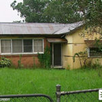
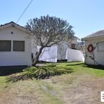
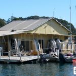
Tammy’s House / Jetty (Mangrove River)
139 Brooklyn Road
Brooklyn NSW 2083
In the final week of the 2020 season, and struggling to cope following the imprisonment of best mate Colby, Dean Thompson retreated to his old hometown of Mangrove River, where he proceeded to drown his sorrows at local bar The Mangrove. After getting into a brawl and hearing sirens approaching, Dean make a quick exit […]
Astoni City House
3 Stamford Avenue
Cabarita NSW 2137
Viewers were first introduced to the Astoni family—consisting of parents Ben and Maggie and their two daughters Ziggy and Coco—in June 2017. Brody Morgan, who was attending a Narcotics Anonymous meeting in the city, bumped into Ziggy in the toilets of a community centre as she hid from her dad Ben. Brody later assisted by […]
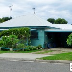
Cheryl Braxton’s House
67 Wimbledon Avenue
North Narrabeen, NSW 2101
Not long after the arrival of the Braxton brothers—Darryl, Heath and Casey—back in 2011, we visited the family home in the trouble town of Mangrove River, where we were introduced to their mother Cheryl. The first appearance of their home in Episode 5243 saw Romeo Smith visit in order to help Casey with some homework, […]
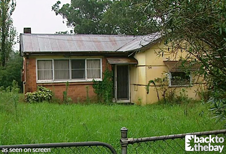
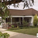
Ailsa’s Childhood Home
94 Crown Street
Riverstone, NSW 2765
After recently finding out that local lifeguard Shauna Bradley was in fact the daughter she gave up for adoption after she was raped by a guard in prison, Ailsa Stewart decided it was time to exorcise some further demons from her past. She visited her childhood home in Victoria, the place where she had killed […]
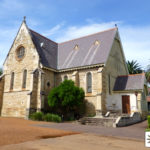
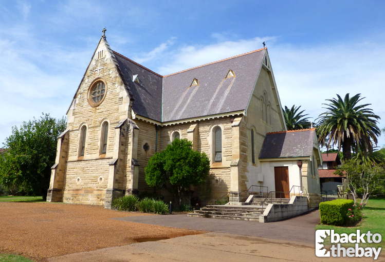
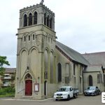
John & Gina’s Wedding / Charlie & Robbo’s Funerals
St Peter Chanel Church
Futuna Street
Hunters Hill NSW 2110
In the 2010 season finale, the residents of Summer Bay gathered for the wedding of Bianca Scott to Italian prince Vittorio Seca. It proved to be one of Summer Bay’s more dramatic weddings, when Bianca faltered during her vows before eventually saying “I don’t”. Bianca ran into the arms of Liam Murphy who swiftly whisked […]
Stacey’s Apartment
1139 Barrenjoey Road
Palm Beach NSW 2108
After losing both her home and fiancé Philip Matheson in the fire at Celia’s Store in April 1989, Stacey Macklin went on to move into a two bedroom apartment elsewhere in Summer Bay, gaining a flatmate in the form of Andrew Foley. There were no actual scenes showing the exterior of Stacey’s apartment during her […]
Henri’s City Home
19 Callistemon Way
Warriewood
NSW 2102
Following her suspension from teaching at Summer Bay High, after it was revealed that she had slept with student Casey Braxton, Henri Brown retreated to her home in the city. When a heartbroken Casey discovered that she had only left town after his brother Brax had forced her to, Casey tracked down her address and […]
Robbo, Jasmine & Tori’s Safe House
Downes Family Farm
Brownlow Hill Loop Road
Brownlow Hill NSW 2570
As Summer Bay celebrated Robbo Shaw and Jasmine Delaney’s nuptials, the residents were shocked when federal police stormed Salt and took Robbo and Jasmine away in the middle of their reception. Unbeknownst to everyone, the newlyweds alongside Tori Morgan were being whisked off into protective custody, and were transported to a safe house in an […]
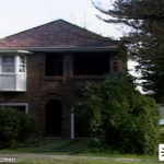
Graham Lynch’s House
55 Phillip Street
Birchgrove NSW 2041
Following the temporary breakdown of her marriage to Alf in August 1988, Ailsa Stewart left Summer Bay to stay with her old friend Graham Lynch (played by Tom Richards) in the city. In Episode 174, we saw Ailsa and Graham sitting outside his home discussing Ailsa’s decision to sell the store to Celia, and the […]
Summer Bay High (2001-2008)
(Former) Peter Board High School
144 Wicks Road
Macquarie Park NSW 2113
In 2001, a new exterior filming location debuted for Summer Bay High School, the third since the show’s inception. Unlike the show’s first and second Summer Bay High exteriors, which were a hospital and hotel respectively, this incarnation utilised an actual former high school, just down the road from the previous locations in the Northern […]
Scarlett’s House
14 Waratah Road
Palm Beach NSW 2108
During the height of Brody Morgan‘s drug addiction in 2017, he found himself commandeering a stranger’s car after smashing up a pawn shop in a desperate attempt for money. The woman, Summer Bay resident Scarlett Snow, gave Brody her bag in order to get rid of them, and the next day (Episode 6653) Brody visited […]
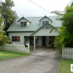
Parrish House
18 Dorset Street
Epping NSW 2121
In 1995, soon-to-be-wed Shane Parrish & Angel Brooks were on the lookout for a marital home, in the knowledge that funds would somewhat limit their options. When an ad in the local paper for a spacious, 2 bedroom house in a ‘top street’ with an affordable rent caught Shane’s eye, the couple were keen to […]
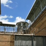
Irene’s Care Home
Garry Owen House
Callan Park
Balmain Rd
Lilyfield NSW 2040
In 2005, Irene Roberts began displaying some worrying symptoms including headaches, acute paranoia and hallucinations of the recently deceased Chloe. With nothing physically wrong with Irene, it was presumed that she was suffering from sort form of psychosis—but little did they know that Irene’s lodger, police officer Corey Henderson, was in fact slowly poisoning Irene […]
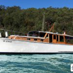
Blaxland (Alf’s Boat)
MV Kangaroo
Princes Street Marina
Newport NSW 2106
Having now served on the show for over 20 years, the Blaxland is almost as much a part of the Summer Bay landscape as the surf club or beach. The Blaxland first appeared on-screen in May 1997, when Travis Nash and Lachie Fraser purchased her off local fisherman Snapper McCracken. The boat later came into […]
James House
10 Darius Avenue
North Narrabeen NSW 2101
In Episode 5523 in 2012, we saw the debut of the James household, home to young tearaway Jett and his unwell mother Liz. With Jett missing a lot of school due to his mother’s illness, as well being responsible for bullying VJ and committing petty crimes around the bay, headmistress Gina and her son Xavier […]
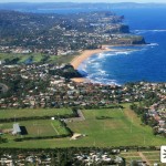
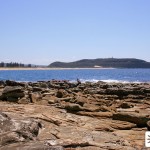
Rocky Point
Bald Hill Headland Reserve
Otford Road
Stanwell Tops NSW 2508
In Episode 1863, Alex Bennett & Shannon Reed went hang gliding with some friends of Alex’s, Phil & Georgie, who had come to the bay to view Angel & Shane’s house and decided to take advantage of a nearby launch site at Rocky Point. When Phil & Shannon’s tandem hang glide took an unexpected landing, […]
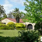
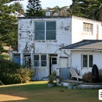
Blaxland Mansion
Summerlands
128 Pacific Road
Palm Beach NSW 2108
In 1989, following the breakdown of her marriage to husband Richard, Morag Bellingham moved from her city mansion to another grand house which she had chosen to renovate, back in her home-town of Summer Bay. Named as the ‘Blaxland house’ on the show, the location debuted in Episode 261, which also saw it appear in […]
Saul’s Cult Farm
10 Boondah Road
Warriewood NSW 2102
In the closing weeks of 1995, Selina Roberts and Shannon Reed met Saul Bennett, after he came to their rescue when their car broke down. Saul ran a commune named ‘The Children of Saul’, that was based on a farm the other side of Yabbie Creek, but it soon became apparent that it was nothing […]
Adam’s Wharf / Harling Apartment
2 Snapperman Lane
Palm Beach NSW 2108
One of countless wharves seen on the show over the past three decades, this particular jetty was seen in the months following Adam Cameron’s arrival in 1989, as the location where he moored his yacht. The result of an inheritance from his late parents, the yacht didn’t bring much luck for Adam—no sooner had it […]
Jennifer’s House
6 Waratah Road
Palm Beach NSW 2108
In September 1990, Alf Stewart’s cousin Jennifer Atkinson arrived in the bay, and it soon became apparent that she was fleeing from her abusive husband, Daniel. Deciding to settle back down in the area she grew up in, Jennifer moved into a house which was said to be around half an hour outside the bay […]
Andrew & Donna’s Flat
95 Princes Lane
Newport NSW 2106
In April 1995, Donna Bishop moved in with her boyfriend Andrew Warren, an old flame she’d recently reunited with despite his history of violence towards her. The relationship wasn’t to last much longer however, with Andrew lashing out at Donna over her friendship with Rob Storey a little over a week later. The real-life exterior […]
Summer Bay High (1996-2001)
MGSM Executive Hotel
Macquarie University
99 Talavera Road
Macquarie Park NSW 2113
After the 1996 earthquake mostly destroyed Summer Bay High School in Episode 1975, a hasty rebuild in the space of a few weeks brought about a new filming location for the school’s exterior scenes, which had been filmed at a hospital in North Ryde since the show’s inception. The new location, which we believe debuted […]
Summer Bay High (1988-96, 2000, 2008-09)
Macquarie Hospital
Wicks Road
North Ryde NSW 2113
Making its debut in Episode 1 of Home and Away, Summer Bay High School has remained one of only two current buildings within the town to be seen on-screen from the very beginning. Over the past three decades, there have been no less than six different filming locations that have been used for the exterior […]
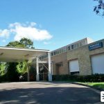
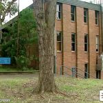
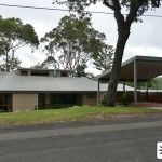
Northern Districts Hospital (1994-2010)
Macquarie Hospital
Wicks Road
North Ryde NSW 2113
In the closing weeks of 1994, Roxy Miller had to undergo treatment for breast cancer, and the show introduced a new exterior location for Yabbie Creek’s Northern Districts Hospital. This particular location—Macquarie Hospital, a specialist mental health residential facility in the NW Sydney suburb of North Ryde—was already very familiar to the Home and Away […]
Nash / Fraser Apartment
1/7 Birdwood Avenue
Collaroy NSW 2097
In 1997, Travis Nash and Rebecca Fisher decided to get their own place together, and found themselves a perfect apartment next to the beach, which they moved into in Episode 2276. With Travis and Rebecca moving into Summer Bay House following the departure of Pippa Ross in early 1998, the apartment was taken over by […]
Dylan’s Baptism
St John's Church
81 Alt St
Ashfield NSW 2131
Following young Dylan Parrish’s diagnosis with leukaemia in 1995, the decision was taken by Shane & Angel to have him baptised.
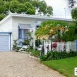
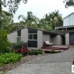
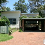
Morgan House
13 Harley Road
Avalon Beach NSW 2107
Episode 6442 in 2016 saw the introduction of the Morgan brothers—Justin, Brody and Mason—siblings to the already established character of Tori. Their arrival in Summer Bay coincided with the debut of a new residence to house the family and their Boxer dog, Buddy. The real-life house, used for exterior scenes, is nestled on Harley Road […]
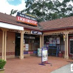
Stewart Supplies
Careel Bay Marina
94 George Street
Avalon Beach NSW 2107
First appearing in Episode 6 (the exterior in Episode 42) in 1988, Stewart Supplies was the first of three bait shops that Alf has run over the years. Offering boating services and also acting as the local bottle shop, the store started stocking groceries the following year when Alf joined forces with his sister Celia—following […]
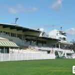
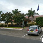
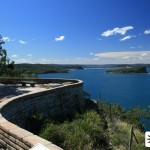
Yabbie Creek Racecourse (2010)
Hawkesbury Racecourse
Racecourse Road
Clarendon NSW 2756
In Episodes 5162 & 5163 in 2010, Nicole, Charlie, Angelo and Angelo’s brother Paulo spent the day at the races at Yabbie Creek Racecourse. As is usually the case with racecourse visits, things didn’t quite go to plan—with Paulo losing a considerable amount of money, and Charlie having to jump off the catwalk to tackle […]
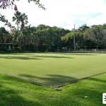
Yabbie Creek Bowling Club (2007)
Avalon Beach Bowling & Recreation Club
Bowling Green Lane
Avalon Beach NSW 2107
In Episode 4395 (April 2007), Colleen Smart rallied a team together for the great bowls tournament in Yabbie Creek against her nemesis Betty Allsop. Though Colleen’s team won, there was shock all round when the club president, Cess, accused Colleen of ball tampering (an act committed by Drew Curtis) and banned her for life! The […]
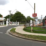
Laura’s Death
Oaks Street Level Crossing
Thirlmere NSW 2572
In 1995, an Italian exchange student named Laura Bonetti came to stay in the Stewart household. With both Curtis and Jack falling for her, it became obvious from the outset that Laura’s thirst for excitement and disdain for authority was going to cause problems. Laura was soon dragging Curtis into mischief, making the front page […]
Share House (2013-present)
55 Elaine Avenue
Avalon Beach NSW 2107
First introduced to the show in 1998, the house most commonly known as the Braxton House in recent years (but officially known by the powers that be as the ‘Share House), moved to it’s fourth filming location in 2013, along with the Palmer House next door. Like it’s predecessor, the house is located in the […]
Palmer House (2013-present)
57 Elaine Avenue
Avalon Beach NSW 2107
First introduced to the show in 2005 with the debut of the Holden family, the house now occupied by John Palmer & Marilyn Chambers moved to it’s second filming location in 2013, along with the Braxton House next door. Like it’s predecessor, this house is located in the suburb of Avalon Beach—and was first introduced […]
Gibson House
50 Elaine Avenue
Avalon Beach NSW 2107
Episode 753 in 1991 saw the introduction of the Gibson House, home to Revhead, his sister Julie (played by future Hollywood star Naomi Watts), and their father Alec. The house was seen sporadically over the next couple of months, with Nick Parrish starting up a shortlived relationship with Julie, Alec’s sudden death from a heart […]
Garner / Saunders / Jefferies House
18 Woodridge Avenue
North Epping NSW 2121
This filming location is quite unique in that it’s been used as no less than three separate Summer Bay residences over the years. It was first used in 1998 as the home of local police officer Terri Garner, seen frequently when Terri embarked on a relationship with Tom Nash – not knowing that he was […]
Ellis / Fraser House
Snappermans Cottage
33 Iluka Road
Palm Beach NSW 2108
When Sam Marshall started a paper round in 1998, he delivered to a house where he saw the girl of his dreams meditating in the garden. The girl was Daria Ellis, who had recently moved to the bay with her father Sean who had just opened a surf shop. Sam and Daria eventually embarked on […]
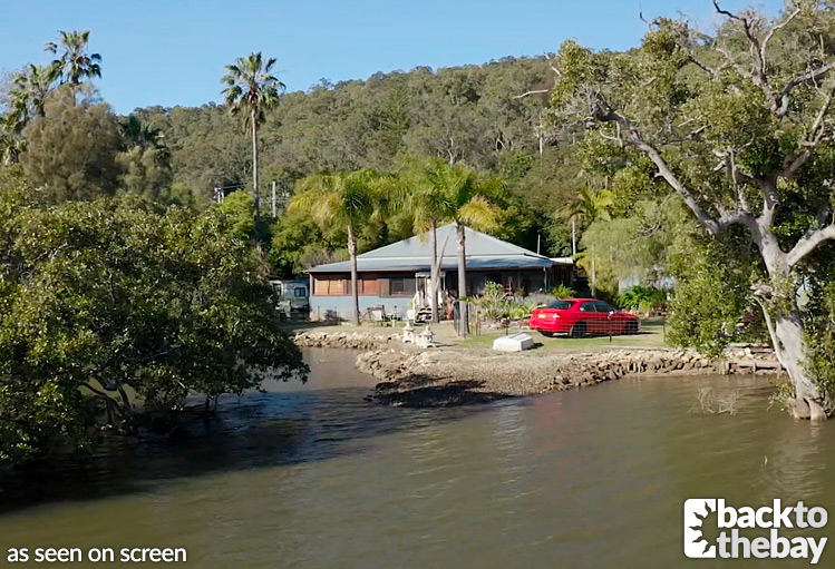
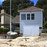
Beach House (2001-2025)
66 Mactier Street
Narrabeen
NSW 2101
Scenes outside the iconic Beach House location, first introduced in 1990, gradually declined in the late 90s for reasons unknown. In 1999, stock shots of the house disappeared from our screens altogether, and were instead replaced with shots of Clareville Beach. When it came to needing new stock shots in 2001, an alternative location was […]
Meg’s Funeral
West Pennant Hills Community Church
41-43 Eaton Road
West Pennant Hills NSW 2125
The 1992 storyline between Blake Dean and Meg Bowman became Home and Away‘s most famous tragic love story. Terminally ill with leukaemia, Meg made an instant connection with Blake, but for obvious reasons her mother was against a romance. Eventually she relented and Meg was able to spend her final weeks in a loving relationship […]
Reefton Lakes Bank (2008)
(Former) Westpac Avalon Beach
49 Old Barrenjoey Road
Avalon Beach NSW 2107
In an attempt to fleece Leah Patterson-Baker of her insurance payout following Dan’s death, conwoman Bridget Simmons forged Leah’s driving licence and stole some other forms of ID from the house. With Leah’s existing account being at the Yabbie Creek branch, Bridget visited the Federation Bank in Reefton Lakes in Episode 4768, in order to […]
Lily’s Hostel
15 Malcolm Street
Narrabeen NSW 2101
When Lily Nelson, who was staying at Summer Bay House after escaping an abusive boyfriend and her mother, witnessed Ric Dalby hit Jules Monroe, she felt threatened and did not wish to stay in the house. She temporarily moved to a hostel where Sally & Cassie visited her in Episode 4399, followed by Ric who […]
Elliot’s House
4 Milsted Road
Terrey Hills NSW 2084
In Episode 4684 (2008), Nicole Franklin visited the home of Elliot Gillen, the brother of an old army friend of her father Roman. After recently meeting Elliot for the first time, Roman had his suspicions as to Elliot’s motives for turning up in the bay. When Nicole, who was supposed to have gone to visit […]
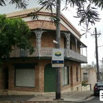
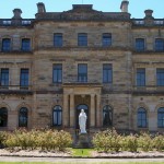
Bellingham Mansion
'Huaba'
6 Ernest Street
Hunters Hill NSW 2110
First seen in 1988, this grand house in “the city” was the marital home of Morag Bellingham and her husband Richard, who had lived there for over 20 years. The house was first seen in Episode 108, when Roo went to stay with Morag following her aborted wedding to Frank Morgan, and appeared a few […]
Robertson House
27 Chelmsford Avenue
Epping NSW 2121
In Episode 4026 (2005), after seeing his father Barry hand over a box to a woman in the street, Kim Hyde tracked down the woman who he believed was his mother Kerry. He visited her home where she all but confirmed his belief, and told him that she wanted nothing to do with him. In […]
Naomi’s Apartment
11 Devitt Street
Narrabeen NSW 2101
Following the scandal of the past relationship between Lucas Holden and Summer Bay High temp teacher Naomi Preston, she moved back to the city. In Episode 4463, Lucas tracked down her apartment in the city and watched her from the street. He returned in the following episode and, unfortunately for him, was seen by Naomi […]
Harry’s Kidnap
130A Booralie Road
Duffys Forest NSW 2084
In August 2008, Rachel & Tony Holden’s baby Harry was abducted. Though Rachel suspected Jane Avent, a woman who had recently lost her baby at the hospital and had started following Rachel around, the police found no evidence. When Rachel bumped into a letting agent in Episode 4922, who spoke of a studio cottage that […]
Reefton Arms Hotel
Alexandria Arms
35 Henderson Rd
Alexandria NSW 2015
In 2012 (Episodes 5584–5585), Danny Braxton forced his son Casey into taking part in an armed robbery on the Reefton Arms Hotel. When Danny threatened him into killing a staff member he’d taken hostage, Casey instead turned the gun on Danny and shot him dead. In reality, the Reefton Arms Hotel is the Alexandria Hotel, […]
Watson House
23 Castlereagh Road
Wilberforce NSW 2756
George Watson (not to be confused with fellow cop Georgina Watson!), was a corrupt police officer who was partnered with Jack Holden for some time in 2007. Jack was witness to George taking bribes, and whilst George told Jack that he wouldn’t continue, Jack still had his suspicions and followed George home in Episode 4524. […]
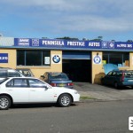
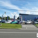
Moran Motors
Peninsula Prestige Autos
33 Warraba Road
North Narrabeen NSW 2101
In Episode 4169 (2006), Ric Dalby started an apprenticeship at Ray Moran‘s garage. Whilst there he fell foul to pranks from his fellow workers, and ended up making a rather dangerous enemy in the form of Ray’s nephew Dom. Eventually Dom was fired, and Ric continued to work at the garage until early 2008. Drew […]
The Sands Resort (1989-91, 2007)
Stamford Grand North Ryde
Cnr Epping & Herring Roads
Macquarie Park NSW 2113
Summer Bay’s Sands Resort, built by Gordon Macklin, opened it’s doors in Episode 389 in 1989. It’s first exterior appearance on screen was in the previous episode, and the real-life hotel used for it’s first incarnation, the first of at least three, was the Stamford Grand North Ryde in Macquarie Park (the suburb was previously […]
Federation Bank (2007)
NAB Windsor
141 George St
Windsor NSW 2756
In Episode 4532 (2007), Irene, Geoff and Martha all visited Frank McIntosh, the branch manager of the Federation Bank in Yabbie Creek, in an attempt to reason with him about taking possession of the Campbell Farm only days after Bruce’s death. In the same episode, the bank was robbed by Colin Marshall, with Jack Holden […]
Peter & Amanda’s Wedding
Dural Gardens Bed & Breakfast
24 Sagars Rd
Dural NSW 2158
Episodes 4382/4383 (2007) saw the wedding of Amanda Vale to Peter Baker, in the gardens of a grand country house. Being a Summer Bay wedding, things didn’t go smoothly of course, with the ceremony being ruined by Ethan Black (Amanda’s sister Kelli‘s partner in crime) only seconds after Peter had kissed his bride. The wedding […]
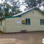
Summer Bay Church Hall (1988-1989)
Maraylya Hall
346 Boundary Road
Maraylya NSW 2765
The exterior of the Summer Bay Church Hall was seen prominently in Episodes 57–58 whilst preparations for the Easter dance got underway. It was next seen in 1989, re-branded as the Summer Bay Community Centre, as the location where Martin and Lance were trying to sell their Bunyip toys in Episode 402, with Lance keeping […]
Franklin House
1 The Greenway
Duffys Forest NSW 2084
In Episode 4743 (2008), Geoff Campbell took Nicole Franklin to visit her mother Natalie in the city. Whilst there, Natalie threw a party in Nicole’s honour, but Nicole later found that the sob story her mother had told her on the phone had been a ruse. Natalie wanted Nicole to move home so that she […]
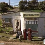
Hogans General Store
Former Beacon Store
Lot 132, Governor Phillip Park
Palm Beach
NSW 2108
We were introduced to Ailsa Hogan’s store in the Pilot episode, when new resident Pippa Fletcher went to pick up groceries, meeting Ailsa and local gossip Doris Peters. When Ailsa set up the Bayside Diner with Bobby Simpson in late 1988, she sold the store to Celia Stewart. The store appeared for the final time […]
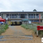
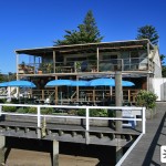
Summer Bay Surf Club
North Palm Beach Surf Life Saving Club
Governer Phillip Park
Palm Beach NSW 2108
If there’s one place that fans head to when they visit Palm Beach, it’s the North Palm Beach Surf Lifesaving Club. With the possible exception of the beach, this building is easily the most famous and recognisable location used on Home and Away, with tourists flocking to have their picture taken in front of the […]
Barbara’s House
15 Cove Street
Birchgrove NSW 2041
In early 1989, Bobby Simpson was on a mission to find out the identity of her birth mother, clues to which lied in the diaries of Alf’s deceased wife Martha. Believing her mother may have been Alf’s sister Barbara, Frank took Bobby to Barbara’s city home in Episode 231. Though she wasn’t Bobby’s mother, Barbara […]
Summer Bay Catholic Church (1988)
Our Lady of the Rosary Parish Kellyville
8 Diana Avenue
Kellyville NSW 2155
In Episode 55 we saw Lynn Davenport visiting Summer Bay’s catholic church (of which she had apparently been a regular member of the congregation) whilst having trouble dealing with her faith following recent events. As Father Rawlings welcomed the Barlow family on their arrival, Lynn couldn’t face entering. Later in the same episode she returned […]
Macklin Group HQ
129 Showground Road
Castle Hill NSW 2154
The Macklin Group was owned by Gordon Macklin and employed various characters in the first couple of years of the show, during the inception of the Macklin owned Sands Resort in Summer Bay. Gordon’s office was located at the company’s main headquarters in ‘the city’, and we caught our first glimpse of them in Episode […]
McPhee House
15 Annangrove Road
Kenthurst NSW 2156
In Episode 27, Neville and Floss McPhee decided to pay a visit to their estranged son Scott in the city in a hope to patch things up between them. When Floss arrived however, she was greeted by the housekeeper who mistakenly thought that Floss was there to apply for the job of a nanny to […]
Morris House
47 Jones Road
Kenthurst NSW 2156
The home of Carly Morris’ deceptive father George and her twin sister Samantha, this house was seen in Episode 7 when Tom Fletcher paid them a visit. Despite George and Samantha not living in Summer Bay, the real life location of the house couldn’t be nearer – being right next door to the location used […]
Celia’s House
38 Jones Road
Kenthurst NSW 2156
The exterior of Celia Stewart’s modest home, which was actually her parents home before they emigrated to Tahiti, was first seen in Episode 36 of the show. Strangely, Celia’s house seemed to make it’s last appearance around June 1989 and was never seen again, despite Celia remaining in Summer Bay for a further 10 months […]
Fisher House (1988-1992)
30 Jones Road
Kenthurst NSW 2156
First seen in the pilot episode of the show, this was the location seen as the home of Donald Fisher. It was used frequently for exterior scenes until, having learned the house was subsiding, Donald sold it to fellow Summer Bay resident Joe Bowman in early 1992. Joe then briefly let the house to his […]
Stewart House
49 Jones Road
Kenthurst NSW 2156
The Stewart House was first introduced in Episode 3 of the show as the home of Alf Stewart and his daughter Roo, who had moved there from Summer Bay House a few years earlier following the death of Alf’s wife Martha. Eventually Ailsa moved into the home and the couple stayed there, with their son […]
Cassie & Macca’s House
17 Ritchie St
Rosehill NSW 2142
In the 2006 season finale, Cassie Turner moved to the city with boyfriend Macca MacKenzie, and we later saw their new home during Episode 4333 in 2007. The living arrangements weren’t to last however, as Macca’s true colours shone through once more leading him to hit Cassie again a few weeks later. Cassie promptly moved […]
Amanda’s Mansion
'Alvah'
3 Braeside Street
Wahroonga NSW 2076
In Episode 4199 (aired in June 2006), Amanda Vale breezed back into town to reveal herself as the producer of a movie that was applying for a permit to film in Summer Bay. Amanda wasted no time in making it known that she was a ‘changed’ person and was now rolling in money – which […]
Angelo’s House (2009-2010)
44 Wellman Road
Forestville NSW 2087
Despite being a regular character on and off for the past few years, Angelo’s house has only made a few fleeting appearances. After a few interior scenes around the 2008 season finale and 2009 season opener, which were filmed elsewhere, Episodes 4886–4887 in June 2009 marked the first time we saw the exterior of the […]
Chinatown
Kimber Lane
Haymarket NSW 2000
Having been kidnapped by Suzy Sadiro in the 2009 season finale, Martha MacKenzie was driven to Chinatown by Derrick Quaid in the opening episodes of 2010. However Angelo Rosetta had also hidden himself in the back seat of the car, and knocked Dennis out, setting Martha free. When Derrick came to and shot at Angelo […]
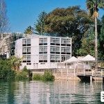
The Sands Resort (2007-Present)
Jonah's
69 Bynya Road
Whale Beach NSW 2108
The Sands Resort, built by Martha MacKenzie’s paternal family the Macklins, has been one of the recurring locations in the show since 1989. Though talked of more often than seen, a number of locations have been used over the years for the times when it did appear on screen. The latest incarnation, first used around […]
Walker House (2009)
52 Dolphin Crescent
Avalon Beach NSW 2107
First seen in Episode 4918, this house was the temporary home of Sid Walker and his children Dex and Indi, during their five-week stint in Summer Bay in 2009. When the family returned permanently in 2010, they moved into the farmhouse recently vacated by Martha MacKenzie. The location, which had only recently been built when […]
The Sands Resort (2003)
Mirage Hotel Newport
Queens Parade West
Newport NSW 2106
The Sands Resort, built by Martha MacKenzie’s paternal family the Macklins, has been one of the recurring locations in the show since 1989. Though talked of more often than seen, a number of locations have been used over the years for the times when it did appear on screen. This particular incarnation of ‘The Sands’ […]
Bledcoe House
60 Dolphin Crescent
Avalon Beach NSW 2107
In Episode 4932 (September 2009), Ruby Buckton tracked down the home of her biological father Grant Bledcoe. There she met his wife and tricked her way into the house under the pretence of being a babysitter looking for work. It wasn’t long after Grant returned home that Ruby confronted him about raping Charlie and she […]
Radcliffe House
2 Alexander Road
Avalon Beach NSW 2107
In Episode 4980 (2009), when it became apparent that VJ Patterson was being bullied by Riley Radcliffe, Leah and Miles went to visit Riley’s father Ian. When Miles was later beaten up by a gang of youths, he went back to the Radcliffe House and realised that Riley was one of the perpetrators. His resulting attempt […]
Patton House/Office
17 Burrawong Road
Avalon Beach NSW 2107
In March 2010, Charlie Buckton started seeing a counsellor, Michael Patton, over the commitment issues she was facing in her relationship with Angelo Rosetta. She kept these sessions a secret from Angelo, and as a result, he became suspicious of Michael – going so far as to follow Charlie to a session and spy on them […]
Palmer House (2009)
34 Albert Road
Avalon Beach NSW 2107
Episode 4828 in 2009 saw the introduction of the Palmer house, home to Trey and his parents John & Jenena. It was only seen on screen a couple of times, the last time being when Gardy robbed the house a couple of months later. After his divorce from Jenena, John was seen to have moved into a […]
Jones House
32 Albert Road
Avalon Beach NSW 2107
The Jones household, home of Melody and her parents Christine & Edward, was seen in various scenes throughout 2008. The location is in the Northern Beaches suburb of Avalon, in an area used regularly for filming, and lies next door to the house used as the Palmer House. The most recent incarnation of Leah’s House is also further […]
Patterson House (2009-2015)
12 Albert Road
Avalon Beach NSW 2106
After 14 years on screen by that point, and after nearly a decade of using an established location nearby, Leah’s House moved to its third filming location in 2009. Viewers first saw the latest incarnation of the house in Episode 4836, in a one-off appearance when Charlie’s car was vandalised during her relationship with Joey […]
Mick’s Caryard
CarBiz
61 Darley Street
Mona Vale NSW 2103
In Episode 5033 (2010), Liam Murphy decided to buy a new car, and so accompanied by Martha, he paid a visit to Mick Morelli’s caryard. After much deliberation he ended up buying not a car, but a motorbike. The real-life caryard used for the episode lied in the Northern Beaches suburb of Mona Vale, on […]
Peter & Zoe’s Flats
Flats 6&7
43 Adams Street
Curl Curl NSW 2096
In early 2006, Peter Baker returned to the bay to secretly await the anticipated return of Summer Bay stalker Zoe McCallister, who he’d found out had survived the factory explosion the previous year. When Zoe eventually returned, she was a lot closer to home than Peter realised – and through Zoe’s games (including a fake […]
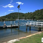
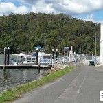
Blaxland Wharf (2004-Present)
McCarrs Creek Reserve
McCarrs Creek Road
Church Point NSW 2105
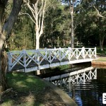
Having been used various times over the years, including in 1992 for Bobby & Greg’s wedding, this reserve started being seen prominently from 2004 onwards as the Summer Bay wharf where Alf’s boat ‘The Blaxland’ was moored. Numerous scenes have been filmed on the wharf and the area surrounding the creek, Leah & Dan’s wedding […]
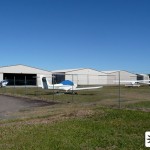
Amanda’s Airfield
Warnervale Aerodrome
Jack Grant Avenue
Warnervale NSW 2259
In Episode 4152 (2006), fearing her imminent arrest for the suspected murder of Josh West, Amanda Vale fled from her apartment to catch a plane with her son Ryan. However only seconds after arriving at the airfield the police caught up with her, promptly taking Amanda into custody. In order to film the airfield scenes […]
Sarah MacKay Drop-in Centre
33 Post Office Street
Carlingford NSW 2118
In 2000, Mitch McColl and Hayley Smith found a homeless girl, Sarah MacKay, drowned in a stormwater drain in the bay. Having lived on the streets himself, it struck a chord with Mitch and he decided to set up a place in the bay for kids in their time of need. After some initial setbacks […]
Doyles Point Wharf / The Mangrove
Kangaroo Point
Pacific Highway
Brooklyn NSW 2083
In early 2009, Aden Jefferies started work on Don Gibson‘s prawn trawler, located at the previously unseen Doyles Point Wharf in Summer Bay. In reality the wharf is at Kangaroo Point in the Hawkesbury River town of Brooklyn, a town which was used for various locations throughout 2009. The wharf is located just off the […]
Jack’s Boat Wharf
Dolphin Boatshed Marina
Brooklyn Road
Brooklyn NSW 2083
In late 2008, Martha MacKenzie purchased a rundown boat for husband Jack Holden, however he didn’t get a chance to enjoy it as only a week later Jack was shot dead. In the weeks following Jack’s death, Rachel grew suspicious of Tony’s sneaking out in the middle of the night. On one such occasion she […]
Beach House (1990-1999)
28 Delecta Avenue
Clareville NSW 2107
With over 25 years clocked up on the show so far, the Beach House stands as one of Summer Bay’s most iconic locations. It’s debut on the show came in Episode 516 in 1990, when Adam Cameron and Matt Wilson rented the house from owner Ernie Jacobs. Ernie later sold the house to Marilyn Chambers, […]
Roman’s Townhouse
4/2 Myola Road
Newport NSW 2106
Making its debut in October 2007 in Episode 4523 (it’s exterior via a stock shot in 4526), the townhouse was first seen when Brad Armstrong rented it to make a proper home for himself and half-sister Tam. However a month later Brad and Tam left for Tasmania, and Roman Harris took over residence of the […]
Liam’s Shop
Brooklyn Motel
7 Bridge Street
Brooklyn NSW 2083
In Episode 4944 (2009), having recently moved to the bay, Liam Murphy bought an old run-down restaurant with a view to renovating it and starting up a music shop. He enlisted Romeo to help him with the renovation, who ended up in hospital when he held a party there without Liam’s knowledge and drank a […]
Fraser House (2005)
16 Cliff Avenue
North Wahroonga NSW 2076
Following the death of Chloe Richards in Episode 4001, her daughter Olivia was placed in the custody of her paternal grandmother, the devious Diana Fraser. In Episode 4012, after a pleading phone call from Olivia who hated living with her grandmother, Irene travelled to Diana’s house to see her. Irene comforted Olivia briefly through the […]
Summer Bay House & Caravan Park (1988-2002, 2015-)
138 McClymonts Road
Kenthurst NSW 2156
As the only house to still be seen on screen since the Pilot episode, Summer Bay House cannot be described as anything short of iconic. However there may be a few people who are unaware that the house seen frequently in stock shots for several years, was at one point, no longer standing. In December […]
Michelle’s House
14 Chelmsford Avenue
Epping NSW 2121
In Episode 4924 (2009), after the shock of finding out her sister Charlie was actually her mother, Ruby Buckton turned up on her Auntie Michelle’s doorstep where she was able to find some answers. In reality Michelle’s house is located in Epping, a few doors down from the Nader House, and a minute or so […]
Old Tyre Factory
81 Riverstone Parade
Riverstone NSW 2765
In 2005 (Episodes 3951–3953) we saw the conclusion of the ‘Summer Bay Stalker’ storyline, with nurse Zoe McCallister (aka Eve Jacobsen) holding Sally hostage in an old tyre factory just out of town. It was believed that Zoe had died in the resulting explosion but she returned the following year to cause more havoc. Peter […]
Liam’s Motel
Best Western Colonial Motel
161 March Street
Richmond NSW 2753
In Episode 4864 (2009), Liam Murphy ended up on the roof of his motel whilst high on drugs, Aden went up in an attempt to coax him down and nearly ended up plummeting to the ground following a scuffle. The motel is located in Richmond, approximately 60km northwest of Sydney and near the well used […]
Nader House
2 Chelmsford Avenue
Epping NSW 2121
In 2006, Martha MacKenzie started seeing local cop Ash Nader. Little did she realise that he had a wife and children, a fact that was learnt by viewers in the 2006 Season Finale when we saw the Nader family home. The real life house, also seen a few weeks later in 2007 when Martha visited, […]
Yabbie Creek Cellars
North Epping Cellars
Shop 3
30 Roma Street
North Epping NSW 2121
In Episode 4862 (2009), Gardy forced Roman Harris to take part in an armed robbery at Yabbie Creek Cellars, which ended in tragedy when an elderly customer had a heart. Despite the urgency of the situation, Roman stopped to administer CPR to the woman before making his escape. In reality the shop is situated not […]
The Rocket Club
Camperdown Music Academy
128 – 130 Pyrmont Bridge Road
Camperdown NSW 2050
In 2007, Martha MacKenzie met Cam Reynolds who offered her a job at his establishment – The Rocket Club. The club would end up being one of the most dramatic locations for 2007 as far as Martha’s storylines go – with her first getting caught up in a drugs bust, being spotted by friends and […]

The Farmhouse
Rosemont
87 Level Crossing Road
Vineyard NSW 2795
In 2007 we were introduced to Bruce Campbell and his grandchildren Geoff and Annie, who lived on a farm a short distance from Summer Bay. The family became integrated into the show with several storylines playing out on the farm until Bruce’s death a few months later. The bank repossessed the farm, and Geoff and […]
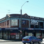
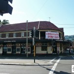
City Pub (Sam & Noel)
Annandale Hotel
17 Parramatta Road
Annandale NSW 2038
In Episode 4599 (2008), Sam Holden visited a shady gentleman in a city pub. When he later turned up on her doorstep, it transpired that she was going to pay him to beat her up, in an attempt to remove suspicion of her for Johnny Cooper’s murder. The establishment she visited is, in reality, The […]
Collins’ House
3 Government Road
Brooklyn NSW 2083
In Episode 4790 (2009) we were introduced to Joey Collins. She lived with her brother Brett in a house near to the wharf, where she worked alongside Aden Jefferies on Don Gibson’s prawn trawler. After being raped by co-worker Robbo, she ended up moving in with Charlie Buckton and embarking on a short lived relationship […]
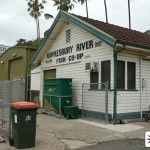
Summer Bay Fish Market
Hawkesbury River Fish Co-Op
1 McKell Park
Brooklyn NSW 2083
In Episode 4953 (2009), Ruby Buckton commenced work at the Summer Bay Fish Market, where Detective Robertson later came to ask her questions regarding the murder of her biological father Grant Bledcoe. In reality the building is the Hawkesbury River Fish Co-Op, which sits at the rear of the Life Boat Seafood restaurant in Brooklyn. […]
Young St. Medical Centre
92 Evans Street
Rozelle NSW 2039
In Episode 4565 (2008), Henk Van Patten visited his old doctor in the city and found out he was HIV Positive. To make matters worse, he later discovered he had inadvertently transferred the virus to his girlfriend Cassie Turner. The building used for the surgery is in the Inner West Sydney suburb of Rozelle, on […]
Boadle Rehab Centre
Weemala Hospital
Royal Rehabilitation Centre
259 Morrison Road
Ryde NSW 2112
Following Belle’s collapse at Rachel and Tony’s wedding in 2009 from an overdose, she was admitted to the Boadle Rehabilitation Centre – where she later met the rock star Liam Murphy. The real life location was the Weemala Hospital, which was part of the Royal Rehabilitation Centre in the Northern Sydney suburb of Ryde. The […]
Belle’s Funeral
Northern Suburbs Memorial Gardens and Crematorium
199 Delhi Road
North Ryde NSW 2113
Episode 4917 in 2009 saw the funeral of the much loved Belle Taylor, following her battle with cancer. The funeral was filmed in the South Chapel of the Northern Suburbs Crematorium in North Ryde, with Aden retreating into the memorial gardens to collect his thoughts after the service.
Kitty’s House
9 Warrington Avenue
Epping NSW 2121
In 2006, Belle Taylor headed to the city in search of her birth mother, only to instead find her grandmother Kitty Landsdowne—who was hiding the fact that her daughter, and indeed Belle’s mother, was none other than Amanda Vale. Her home was first seen when Belle visited in Episodes 4160 and 4162, and also a […]
Peter & Amanda’s City House
40 Nelson Street
Annandale NSW 2038
When Drew Curtis split up with Belle Taylor in 2008, he left the bay to stay with his dad Peter Baker and stepmum Amanda. In Episode 4599, both Drew’s mum Jazz and friend Ric visited Drew at the house in an attempt to bring him back to the bay. In reality, the 1890’s Victorian terrace […]
Britt’s House
22 Birchgrove Road
Balmain NSW 2041
Following her husband Jack discovering the truth about Johnny Cooper’s death in 2008, Sam Holden took her son Rory to the city to stay with her sister, Britt Grey. When she later returned without Rory, she committed suicide in an attempt to set up Jack and Martha for her murder. Morag was determined to find […]
City Pub (Jack)
The Riverview Hotel
29 Birchgrove Road
Balmain NSW 2041
In Episode 4618 (2008), Jack Holden visited this pub to track down the guy his wife Sam had paid to beat her up, in order to clear his own name for her murder. In reality the establishment is the listed Riverview Hotel, located in the Inner West Sydney suburb of Balmain, and stands directly opposite […]
Summer Bay Stingers Ground
Pittwater Rugby Park
1472 Pittwater Road
Warriewood NSW 2102
In 2009, Aden Jefferies joined the Summer Bay Stingers footy team, alongside Geoff Campbell and coach Tony Holden. The ground was seen for a few weeks during which the rivalry between Geoff and Lachie Caldwell reached a head, leaving Lachie temporarily paralysed after an awkward tackle. The ground is Pittwater Rugby Park, in Warriewood on […]
Roman/Gardy Bridge
Western Bridge
Sydney International Regatta Centre
Penrith Lakes
89 - 151 Old Castlereagh Road
Castlereagh NSW 2749
In an attempt to cure Roman Harris of his post-traumatic blindness in 2009, Episodes 4855/4856 saw Gardy take Roman to a bridge and push him off it – citing that the fall would shock Roman into seeing again, which after a small delay ended up working. The scenes were filmed at the Sydney International Regatta […]
Mangrove River Wharf
Woolwich Dock
Clarke Road
Woolwich NSW 2110
In 2009, Gardy forced Roman Harris into assisting in the armed robbery of the Mangrove River Storage Company between episodes 4871–4873, which eventually led to the departure of Roman. The real life location, Woolwich Dock, is renowned as one of great historic shipyards of Sydney Harbour. The dock underwent a big development not long after […]
De Bono House
Karala
83 Pacific Road
Palm Beach NSW 2108
Episode 4882 in 2009 saw Donna De Bono arrested for the murder of husband Lou, with the police raiding the luxury hillside home she shared with him. The real life house of course, overlooks Palm Beach, and is one of the many houses available for holiday letting in the area. It’s very rare that the […]
Fletchers’ City House
84 Evans Street
Rozelle NSW 2039
In the Pilot episode back in 1988, we were introduced to the Fletcher family in their Sydney home. Tom was retrenched and so the family decided to move out of the city to the coastal town of Summer Bay. The house used as their city home, seen a fair few times in the Pilot episode, […]
Nash/Patterson House (2000-2009)
13 Edwin Avenue
Avalon Beach NSW 2107
The location used for the home of Leah Patterson-Baker over the last decade.
Osbourne’s Mansion
Bremon
27-31 Chilton Parade
Warrawee NSW 2047
The grand home of Tasha’s father Ian Osbourne, as seen in 2004.
Summer Bay Caravan Park (2007-2009)
Waratah Park Earth Sanctuary
13 Namba Road
Duffys Forest NSW 2084
After very rare appearances over the 2000’s, following the destruction of the real life Jackeroo Ranch in bushfires in 2002, Summer Bay Caravan Park started to make some regular appearances on screen again from 2007. And for those of you who have wondered why emus suddenly started appearing in the Caravan Park, then look no […]
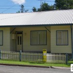
Brad’s Motel
Mount Kuring-gai Motel
705 Pacific Highway
Mount Kuring-gai NSW 2080
Following the wedding to Sally that never was in 2007, Brad Armstrong moved out to stay in a nearby motel, where he later brought half-sister Tam to live with him briefly before moving to the Townhouse. The location is the real life Mount Kuring-gai Motel which stands on Pacific Highway, adjacent to the main Sydney/Newcastle […]
2007 Opening Titles
Dee Why Beach
Dee Why Parade
Dee Why NSW 2099
2007 saw a new set of opening titles featuring the characters pictured in frames around the beach. Unusually, the producers chose not to the usual beaches seen in the show around the time, Palm Beach and Fishermans Beach, and instead opted to use Dee Why beach. The headland seen in the distance is Long Reef, […]
St James’ Church (2006-2009)
St John's Anglican Church
43 Macquarie Road
Wilberforce NSW 2756
First seen as the location of Kim Hyde and Rachel Armstrong’s wedding at the end of 2006, this church in Wilberforce was used for Summer Bay’s church for a couple of years. During it’s tenure it was also used for the wedding of Jack Holden to Sam Tolhurst, and was vandalised (on-screen) after the revelation […]
St James’ Church (1988-2006, 2010-)
St James' Anglican Church
110 Bathurst Street
Pitt Town NSW 2756
St James’ Anglican Church in Pitt Town has been used on and off for Summer Bay’s church, of the same name, since the very beginnings of the show. Memorable ceremonies from the early years of the show include Frank & Roo’s non-wedding, Frank & Bobby’s wedding (though both of these only used the church’s exterior, […]
Pier Diner / Bait Shop
Barrenjoey Boathouse
Governer Phillip Park
1191-1193 Barrenjoey Road
Palm Beach NSW 2108
This already famous location became even more iconic in March 2008, with it being the location for Summer Bay’s new Pier Diner. Bringing the Diner back to Palm Beach enables the crew to work more quickly, due to the fact that its predecessor was half an hour away in Collaroy. The Barrenjoey Boathouse and adjoining […]
Beachside Diner
Warringah Surf Rescue Base
Fishermans Beach
(off Anzac Avenue)
Collaroy NSW 2097
The Beachside Diner was first seen on the show back in 2000, when Alf and Ailsa were forced to find new premises thanks to Colleen’s culinary skills burning down the previous incarnation. In reality the building stands half an hour south of Palm Beach, on Fishermans Beach in Collaroy – the opposite end of the […]
Bayside Diner / Beach House (2025-present)
20 Etival Street
Palm Beach NSW 2108
Set up by Ailsa Stewart and Bobby Simpson, The Bayside Diner was first seen in Episode 226 in the final week of 1988 (the exterior seen in the first episode of 1989), and featured as an iconic location in the show for nearly 12 years. When Colleen accidentally started a chip pan fire in Episode […]
Jefferies House (2008)
12 Burrawong Road
Avalon Beach NSW 2107
Seen in 2008, this house was the family home of Aden Jefferies and his father Larry. It was seen in a few exterior and interior scenes throughout the year, culminating in the storyline where Aden held his father and Rachel Armstrong captive in the shed (though the interior of the shed itself was a studio […]
The Palace
29 Beach Road
Collaroy NSW 2097
First seen in 2002, the ironically named ‘Palace’ was the first home for young couple Hayley Smith and Noah Lawson. It was on screen until 2005 when it was partially destroyed due to a fire, however since then it has mysteriously disappeared. The building was located on the same beach as the Beachside Diner, albeit […]
Josie/Amanda’s Apartment
49 Beach Road
Collaroy NSW 2097
Though not seen on screen often, this building was used as the exterior location of the apartment first occupied by Josie Russell. It was then passed on to Robbie & Tasha before finally being occupied by Amanda Vale, during which time there were a few shots of the building (Episode 4152, 2006) when Amanda tried […]
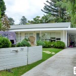
Holden/Palmer House (2005-2013)
31 Whale Beach Road
Avalon Beach NSW 2107
This location was first seen in Episode 4020 in 2005, when the Holden family moved to Summer Bay into the house next door to the Hunters. When Tony and Lucas moved in with the Hunters, the house became known as the Bachelor Pad, before Tony’s sister Gina Austin eventually moved in with her family, later […]
Norfolk Boatshed
114 Iluka Road
Palm Beach NSW 2108
The Norfolk Boatshed was first seen in 1990 in Episode 621, when Ben & Carly Lucini were looking to buy the business. However after much negotiations and a loan from Pippa, their hopes were dashed when newcomer Michael Ross offered the owner $10,000 more than Ben & Carly could afford, and he subsequently bought the […]
Hunter/Braxton House (2005-2013)
33 Whale Beach Road
Avalon Beach NSW 2107
When the Holdens moved in next door to the Hunters in Episode 4020 in 2005, it called for a new exterior location to be found for the Hunter house—a place which had been seen on screen since 1998 and housed residents such as James Fraser, Shauna Bradley and Sally & Flynn. During it’s tenure, the […]
Flat Beach
Station Beach
Governer Phillip Park
Palm Beach NSW 2108
Named in the show as ‘Flat Beach’, Station Beach (also known as Barrenjoey Beach) runs along the western shore of the Palm Beach peninsula overlooking Pittwater. The Barrenjoey Boathouse & Seaplane Wharf (used as the Pier Diner) stands as the main feature on the beach, which extends up to the base of Barrenjoey Headland where […]
Stewarts Point
West Head Lookout
West Head Road
Ku-ring-gai Chase National Park
Ku-ring-gai Chase NSW
Though the location of the fictional Stewarts Point has always been a bit inconsistent over the years, it’s a safe bet to say that this is place which people think of when they hear the name. West Head Lookout was indeed named as being Stewarts Point when Shane Parrish collapsed and died on a rock […]
The River (Michael’s Death)
Deep Creek Reserve
Wakehurst Parkway
North Narrabeen NSW 2101
This location played a major part in the 1996 season, with it being the very place where Michael Ross drowned whilst saving his foster son Sam Marshall during the great storm. Having picked up Sam from footy practice in Yabbie Creek, Michael found that the bridge leading back to Summer Bay had been washed away, […]
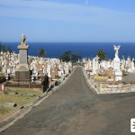
Viv’s Funeral
Waverley Cemetery
St Thomas Street
Bronte NSW 2024
Episode 3856 in 2004 saw the funeral of Alf’s childhood sweetheart Viv Standish (also known as ‘The Guv’), where he found out from her sister Hannah that his and Viv’s son would likely have been adopted by a couple called the Marions. This eventually led Alf to finding out the identity of his recently deceased […]
Yabbie Creek (2004-2009)
The Centre
Darley Street
Forestville NSW 2087
This shopping precinct in Forestville has been used since 2004 for the location of Yabbie Creek. During its first use on screen, Seb & Jade went into Mackinnon & Richardson Real Estate to look for a home. This very building later became the Coastal News offices in 2008 when Belle started working there. The shop […]
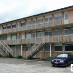
Dani & Ric’s Gaol
Maitland Gaol
6-22 John Street
East Maitland NSW 2323
When Dani Sutherland accidentally knocked down Kane Phillips with her car in 2003, she was convicted of attempted murder and sent to gaol. The scenes were filmed at Maitland Gaol, located north-west of Newcastle in the Lower Hunter Valley around 100 miles north of Sydney. The section seen most often on screen was the A […]
Fisher House (1992-1995)
17 Boronia Avenue
Beecroft NSW 2119
After his former home started to subside, Donald Fisher moved to a new home in 1992, which was first seen in Episode 956. Other characters to live in the house during it’s tenure include Nick & Shane Parrish, Lucinda Croft and Angel Brooks. Sadly for Fisher, this house also came a cropper when it was […]
Josie’s Brothel
Victoria Court Hotel
122 Victoria Street
Potts Point NSW 2011
In Episode 3801 Irene and Dylan track down Angie’s cousin Josie Russell to her place of work – a brothel in Sydney named ‘Leather and Silk.’ In reality the building is Victoria Court, an elegant historic bed and breakfast in Potts Point, just east of Sydney’s CBD. See the Victoria Court website for more information. […]
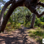
Jump Rock
Warriewood Blowhole
Turimetta Head
Narrabeen Park Parade
Warriewood NSW 2102
Summer Bay’s Jump Rock is somewhat of a local landmark which has been seen many times over the years, however it’s probably most memorable as the place where Steven Matheson and Dodge went flying off into the water after their clifftop fight in 1995. Since then, both Edward Dunglass and Robbie Hunter have taken the […]
Kane’s Trial (2005)
Balmain Courthouse
368 Darling Street
Balmain NSW 2041
In Episode 3903, Kane Phillips appeared in court on the charge of armed robbery, a crime which had in fact been committed by his father. When Kane’s brother Scott lied to the court, framing Kane, it became apparent which way the case was going to swing. By the time the jury announced their guilty verdict, […]
Nash House
20 Currawong Avenue
Palm Beach NSW 2108
Not to be confused with the Nash/Patterson House, which was the old family home of Travis & Joel Nash (and which Joel & Gypsy later moved into for a short time themselves), this location was the home that Joel and his family moved into on their return to Summer Bay in 1998. Located just a […]
Old Yabbie Creek Road
West Head Road
Ku-ring-gai Chase National Park
Ku-ring-gai Chase NSW
This 13km stretch of road in the Ku-ring-gai Chase National Park has had a long history with the show. With it being the road which leads to the infamous Stewarts Point location, it has been seen numerous times over the years. One of it’s most memorable scenes came in 2003 when Dani Sutherland accidentally knocked […]
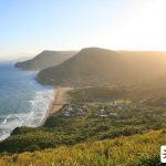
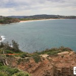
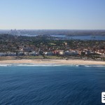
Palm Beach
Palm Beach NSW 2108
This page is currently acting as a placeholder and we will be adding much more information on Palm Beach very soon. The northernmost of Sydney’s Northern Beaches, the real life home of Summer Bay could not be more different to it’s television counterpart. On screen Summer Bay appears to be a small town reached by […]
Rock Pool / The Rocks
Johnny 'Jack' Carter Pool
Ocean Road
Palm Beach NSW 2108
Seen quite regularly in the early 90’s, Palm Beach’s 50m rock pool has made a welcome return to our screens over the past decade. Memorable scenes here over the years include Shannon nearly drowning during her anorexia struggle, Alf’s first love Viv Standish dying in his arms as they reminisced, and the shooting of Charlotte […]
Sally & Flynn’s Wedding
The Lily Pond
Parkes Drive
Centennial Park NSW 2021
Episode 3538 in 2003 saw the wedding of Flynn Saunders & Sally Fletcher, though as with many Summer Bay weddings, the day didn’t go off without a hitch (pun intended). When Sally finally arrived at the ceremony after being thrown off the horse-drawn cart, the heavens opened and the ceremony was rained off. Seeking shelter […]
Beach House (Drive/Garden 1994)
25 Ruskin Rowe
Avalon Beach NSW 2107
A minor location from 1994, this is one of a few properties that have been used as part of the Beach House over the years. When Tug O’Neale found a stray cow on the road in Episode 1488, he brought it home and tied it up in the back garden to keep it safe whilst […]
Bondi Beach
Bondi Beach
Campbell Parade
Bondi Beach NSW 2026
Hayley, Noah, Kirsty, Kane, Dani and Scott visited the world-famous Bondi Beach in Episode 3779 in 2004. It was also seen more recently 2008 when Cassie & Ric were having a break there in Episode 4582, with Matilda and Martha deciding to travel up to break the news about Sally’s attack and Dan’s death. The […]
Wentworth Grammar / Pippa’s OAM
St Ignatius' College, Riverview
Tambourine Bay Road
Lane Cove NSW 2066
Following Bobby Marshall’s death in 1993, her mother Morag Bellingham returned to town and put a scheme in motion to take Bobby’s adopted son, Sam, into her own care. Part of her plan involved enrolling Sam at the prestigious Wentworth Grammar School in the city, and whilst boys are usually enrolled at birth, Morag’s contacts […]
Welcome
If you're visiting Sydney, why not make your trip even more exciting and visit many of the locations that Home and Away has filmed at over the years. From essentials such as Palm Beach (the real-life home of Summer Bay) to less well known locations such as the location of Josie's Brothel, we have details of over 100 real life locations that any true Home and Away fan needs to visit. If you're not lucky enough to have the time or money to visit these famous locations, take a look around anyway and impress your friends with your improved knowledge of the workings of the show.